Who we are
Girish Nagardevalekar

Experienced Senior Sales & operation professional with an established history of working across the Industry segments like ITES, Manufacturing, BFSI, Govt& Defence in IT (information technology) & non IT industry. Believes in customer centricity, collaborative approach &value creation by strategy and thorough execution. He has been leading with an example to ensure that we consistently deliver the value.Multi-Cultural experience having worked at national level for India & Middle East, travelled across India and multiple countries - with companies Wipro, Dimension Data, Ramco Systems, Modi Olivetti, Zenith , 3D Networks. Exposure to multiple business domains at leadership positions, has the ability to understand the critical success factors to run a business.
He loves doing the sales across the industry segments, some know how to manage projects, some know how to support customers, some know how to build a channel, some know how to build a partner eco system, some know how to build a business, wants to build a technology solution sales & support organisation.
What we do
Future I is a technology solutions sales organisation. Our focus is on
Geospatial Solutions
Telematic Solutions
IoT/IIoT solutions
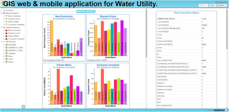
Providing IoT/IIoT solutions, helping enterprises in digital transformation by providing data analytics and actionable insights. Our solution is based on Plant connect industrial IoT platform for smart manufacturing, for remote asset management, for historian and reporting solution, environment data management, Edge gateway – DATcon and custom solution.
IT Infrastructure Consultancy & Solutions
IT Infrastructure and Consulting Services comprise:
- Technical audit of IT infrastructure according to general recommendations, including inventory and compliance with industry principles
- Audit of the IT infrastructure management processes (as per ITIL)
- High-level architecture development of company’s IT infrastructure
- Solution design to optimize IT infrastructure
- Optimization of IT infrastructure management processes (as per ITIL)
Web solutions
We offer expert web solutions as per your requirements suitable for your industry type. We offer template based website designing as well as complex custom crafted web solution that fits your needs.
Our capabilities
Our customers come from many different sectors and backgrounds, and have many unique and interesting problems that they asked us to solve. We are glad to be able to help them with as many aspects of their projects as practically possible. From drafting vision documents to enumerating business goals to improving workflows to bringing their own people on board to helping adopt solution best practices to guiding them on general technology adoption, we have done it all and would love to continue doing it.
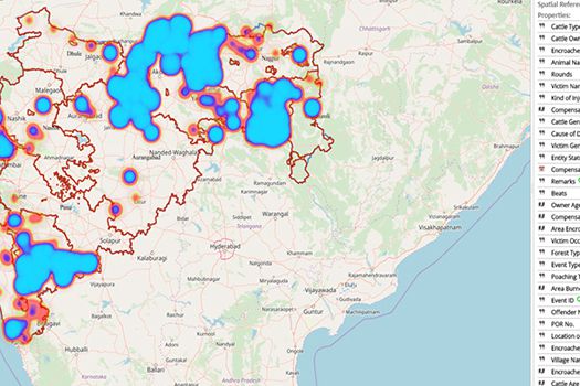
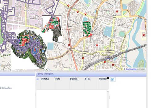
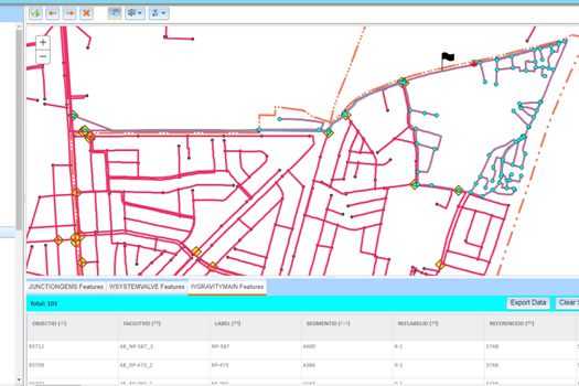
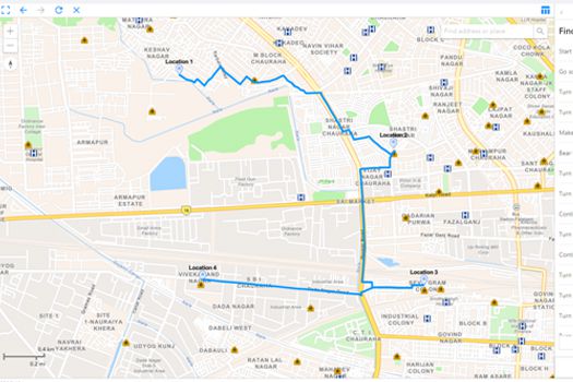
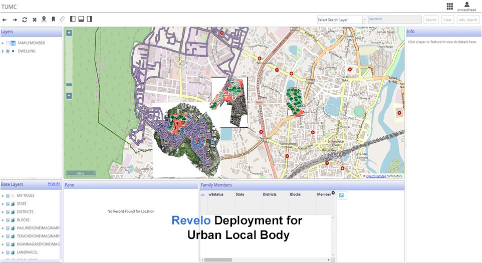
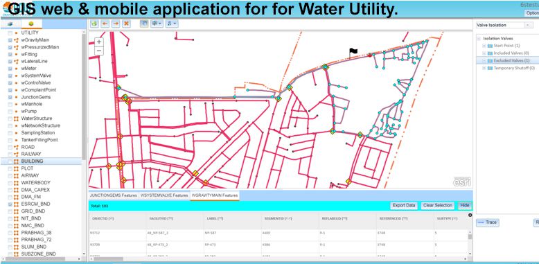
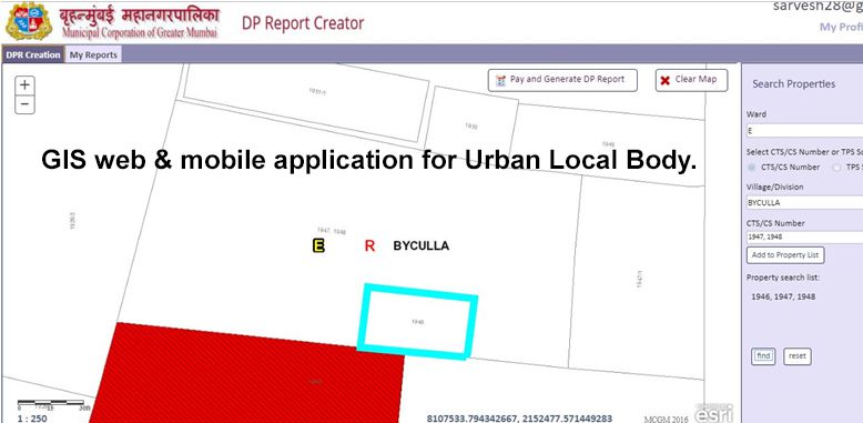
Geospatial Solutions
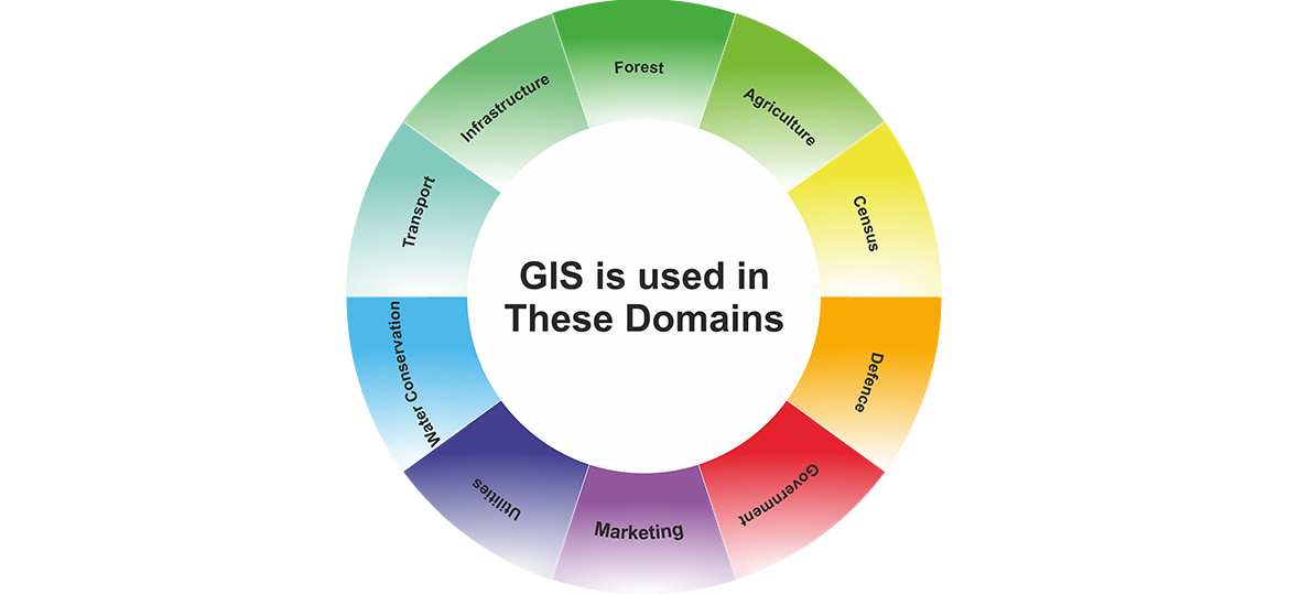
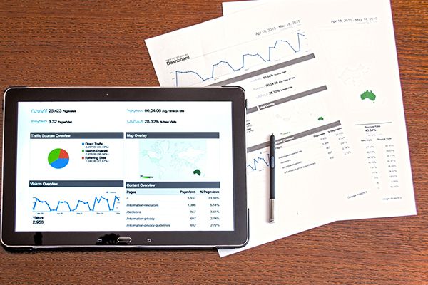
A geographic information system (GIS) is a system designed to capture, store, manipulate, analyze, manage, and present spatial or . GIS applications are tools that allow users to create interactive queries (user-created searches), analyze spatial information, edit data in maps, and present the results of all these operations.
The System to answer question “Where?” is called as geographic information system (GIS).
GIS is utilised by everybody in various forms some of the commonly used GIS application are
OLA Uber Swiggy Zomato etc.
Solutions

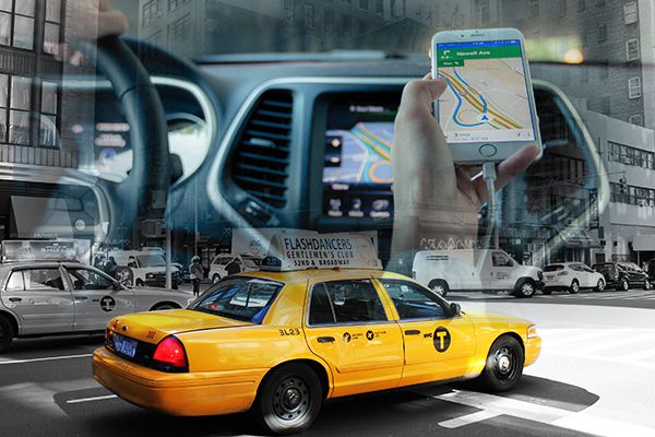
Telematics
Telematics is an interdisciplinary field that encompasses telecommunications, vehicular technologies, for instance, road transportation, road safety, electrical engineering (instrumentation, Sensors, wireless communications etc. & Computer science (multimedia, internet etc.) Telematics can involve any of the following:
the technology of sending, receiving and storing information using telecommunication devices to control remote objects
the integrated use of telecommunications & informatics for application in vehicles and to control vehicles on the move
Global navigation satellite system technology integrated with computers and mobile communication technology in automotive navigation system
This is also called vehicle telematics
Solutions
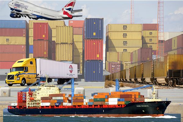
Fleet management solution for logistic industry
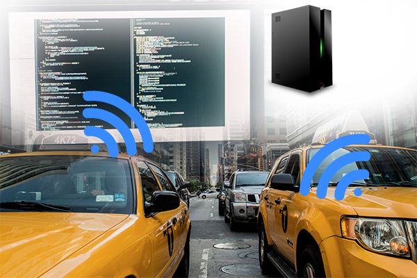
Dispatch management solutions Vehicle Solution for taxi & rentals
Connected car vehicle solution
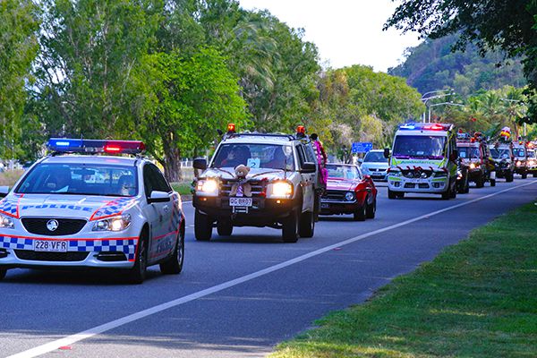
Emergency vehicle tracking management Solution for Ambulance, VIP & Police Vehicles
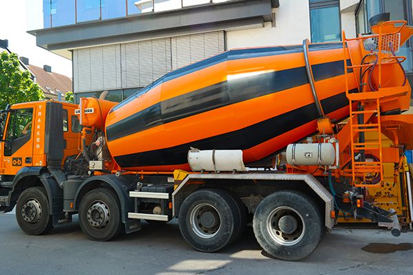
Solution for Ready mix Cement industry
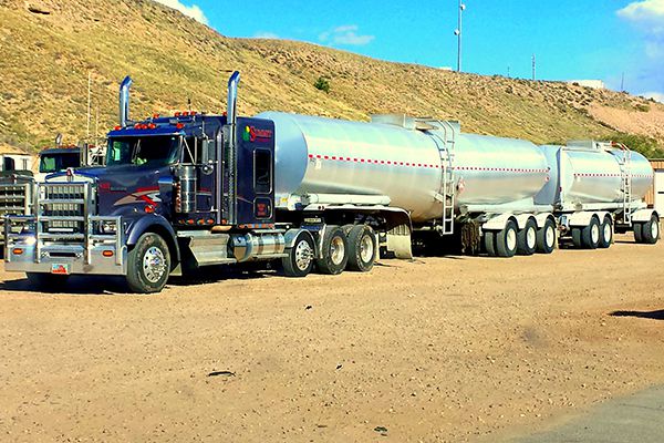
Vehicle tracking Solution for oil & gas & Chemical industry
Solution for Financial segment & insurance telematics
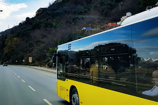
Solution for student/passenger/people transport bus including live video
IoT and IIoT
IoT - The Internet of Things (IoT) is a system of interrelated computing devices, mechanical and digital machines, objects, animals or people that are provided with unique identifiers (UIDs) and the ability to transfer data over a network without requiring human-to-human or human-to-computer interaction.
IIoT – The Industrial Internet of Things (IIoT) refers to the application of IoT within Manufacturing and Service companies. The Internet of Things (IoT), is the network of physical objects or things embedded with electronics, software, sensors, and connectivity to enable objects to collect and exchange data.
Solutions

Smart manufacturing
Every manufacturing setup is continuously striving to master the ‘Manufacturing Puzzle’. SFactory, a ‘Smart Factory’ solution based on AIPL’s Industrial Internet of Things (IIoT) platform. PlantConnect® is your companion in this journey towards Smart Manufacturing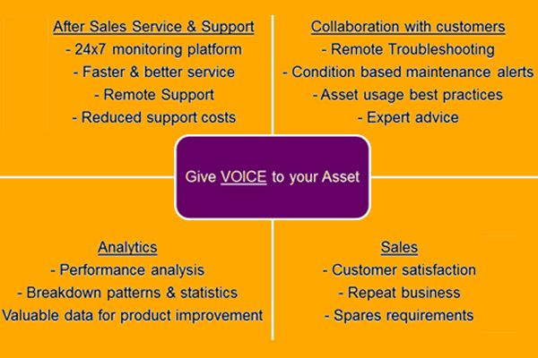
Remote Asset Management System
As OEM, you strive to provide top class ‘After Sales Service & Support’ to your customers and help them maximize Asset ROI through-- Increased asset availability
- Increased asset life
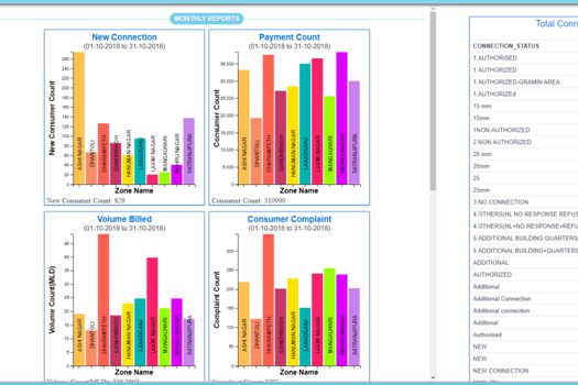
Historian and Reporting Solutions
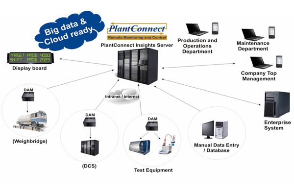
PlantConnect Insights is a real time Data Managment and Reporting solution for Process Plants. It provides aggregation platform for reporting along with Historian. Thus it can be deployed as MIS System for Process Plants.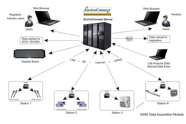
Environment Data Management
EnviroConnect is an IoT solution for Environmental Data Management for- Stack Emissions
- Ambient Air Quality
- Water Quality
- ETP / STP output quality
Data from related equipment like weather stations, flow meters, level sensors, etc. is also acquired into the system. For off line analysers data from files and databases can be integrated into the system.
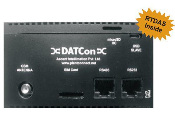
Edge Gateway - DATCon
DATCon, Intelligent Edge Gateway of PlantConnect Platform Runs RTDAS, our powerful Edge Software Works with 3rd party IoT servers
Custom Solutions
PlantConnect is versatile and flexible enough to be adapted for other business cases. We have already worked on several such custom requirements. Some of the cases areElectrical substation monitoring
Cold chain monitoring
HVAC monitoring
Bottling plant monitoring
Solar Grid Monitoring
Future I is a business partner to sell and support all AIPL solutions
IT Infrastructure Consultancy and Solutions
Infrastructure modernisation and automation
Modernise and automate your IT infrastructure to deliver services at the speed the business requires.
Wired and wireless-enabled enterprise
Cognitive, adaptive, modern network infrastructure that supports your business’ digital evolution.
Digital infrastructure security
Dynamic cybersecurity for your digital infrastructure, to enable you to be secure-by-design.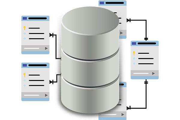
Data architecture and management
Data architecture and management services to help your business get the value you need out of your data.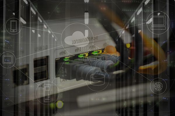
Cloud-optimised hybrid WAN
Increase bandwidth at a lower cost per megabyte, while enhancing application performance and security.Web Solutions
We offer expert web solutions as per your requirements suitable for your industry type. We offer template based website designing as well as complex custom crafted web solution that fits your needs.
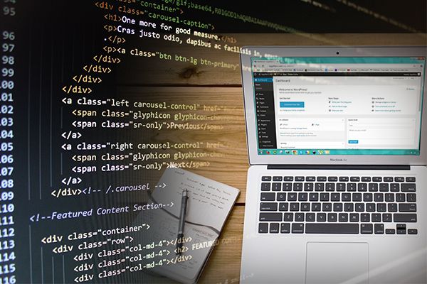
Website and UI designing
We offer simple template based website designing to custom crafted website designing. We also design web application user interfaces as per client's business requirements.
Web applicatons
We design and develop web applications that suit client's business model. Some of them are, E-commerce web applications, Online school admission form application, Subscription management system etc.
Content management systems
We have capability to develop customized content managemnet systems as per client's needs. So far we have developed content management systems for simple corporate website, School website, News portal, Astro business website, Travel solutions provider etc.Solution Clients


Partners


Platforms


Contact us
Get In Touch
Address & Map
Future -I
Keystone Business Hub, Office 11, Second Floor, Bhelke Nagar,
Kothrud, Pune 411038
Hand Phone: (+91) 997 018 1270
Keystone Business Hub, Office 11, Second Floor, Bhelke Nagar,
Kothrud, Pune 411038
Hand Phone: (+91) 997 018 1270